Log in
All resources
Create a design
645 Free Images of Ships On Maps
bibliothèque nationale de france
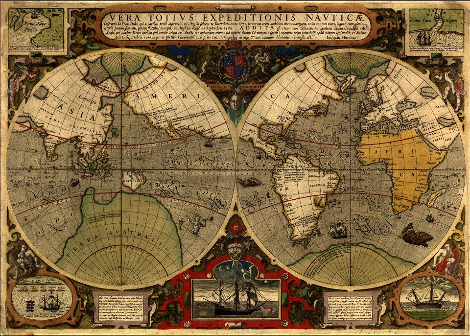
maps by willem and johannes blaeu
maps with cartouches
maps by pieter van der keere
atlas novus (blaeu)
willem blaeu
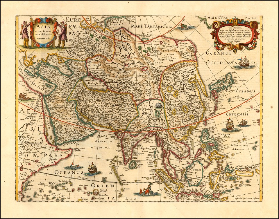
asia noviter delineata
description de l'universe
alain manesson mallet
latin-language maps
old maps of st. augustine, florida
john white (colonist and artist)
maps by willem and johannes blaeu
1640s maps of the ottoman empire
british library king's topographical collection
william henry toms
maps by willem and johannes blaeu
old maps of overijssel
1850s maps of the americas
maps by john tallis
maps by pieter van der keere
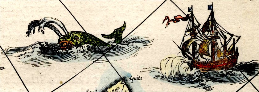
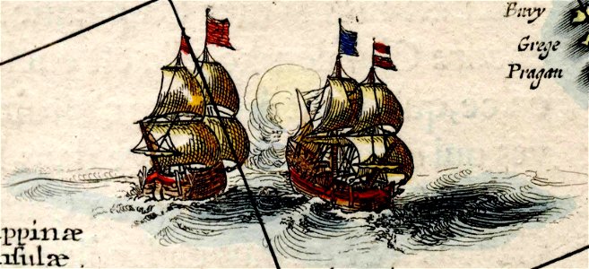
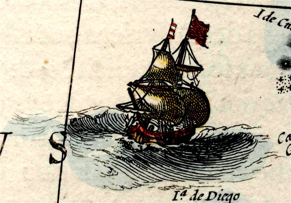
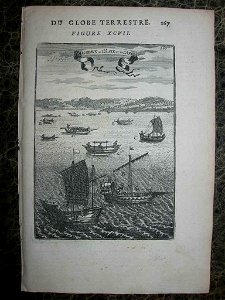
ships on maps
maps of america by guillaume delisle (18th century)
1760s maps of the americas
17th-century maps of crimea
1640s maps of ukraine
coats of arms on maps
ships on maps
1640s maps of the tsardom of russia
17th-century maps of circassia
17th-century maps of the black sea
maps by willem and johannes blaeu
windmills in hoorn, north holland
post mills in north holland
old images of crete under venetian rule
old maps of chania
1640s maps of the tsardom of russia
national coat of arms of russia
maps by willem and johannes blaeu
seventeen provinces
maps by pieter van der keere
old maps of flanders
17th-century maps of the british isles
maps by abraham ortelius
coats of arms on maps
ships on maps
asia noviter delineata
1617 drawings
17th-century maps of the moluccas
latin-language maps
maps by pieter van der keere
maps by abraham ortelius
maps by pieter van der keere
maps with cartouches
maps by jodocus hondius
1590s maps of the world
maps by pieter van der keere
1600s maps of norway
description de l'universe
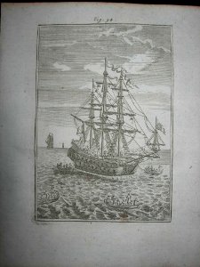
prints of ships
maps by willem and johannes blaeu
maps of barbary coast
maps by willem and johannes blaeu
old maps of stavoren
maps facing east
anton wied
17th-century maps of the near east
maps by willem and johannes blaeu
17th-century maps of crimea
1640s maps of ukraine
the generall historie of virginia (john smith)
1624 books from london
old maps of deventer
schipbrug deventer
history of nord-pas-de-calais
ships on maps
maps by willem and johannes blaeu
ships on maps
maps in the rijksmuseum amsterdam
maps by frederick de wit
asia noviter delineata
1617 drawings
maps made in the 17th century
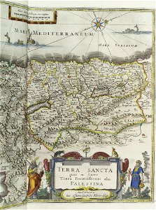
1640s maps of palestine
maps of battles of france
1744 maps
maps by jodocus hondius
1630s maps of asia
maps by matthäus merian
baroque
admiralty charts 1801-2000
maps of tawi-tawi
maps of south america by mercator-hondius
maps in the biblioteca nacional do brasil
1610s maps of the netherlands
maps with cartouches
italian-language maps
giacomo franco
claes jansz. visscher (ii)
leo belgicus
asia noviter delineata
native indonesians
18th-century portrait paintings in the national maritime museum, london
john francis rigaud
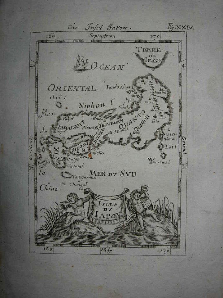
18th-century maps of japan
description de l'universe
asia noviter delineata
1617 drawings
asia noviter delineata
1617 drawings
arctic (ship, 1850)
ss arctic disaster
maps of tangier by braun & hogenberg
maps of asilah by braun & hogenberg
maps in the british museum
maps by john cary
americae 1562 by diego gutiérrez and hieronymus cock
renaissance
maps of tangier by braun & hogenberg
maps of asilah by braun & hogenberg
maps of tangier by braun & hogenberg
maps of asilah by braun & hogenberg
colonial history of the united states
old maps of new york (state)
maps by jodocus hondius
1628 maps
maps by willem and johannes blaeu
1635 maps of africa
maps by willem and johannes blaeu
1638 maps of asia
a visit to the indian archipelago, in h.m. ship maeander
a visit to the indian archipelago (1853) by keppel
maps by pieter van der keere
1610s maps of belgium
maps in the british museum
1610s maps of ireland
description de l'universe
1683 prints
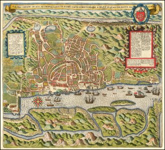
maps of goa by braun & hogenberg
maps of diu by braun & hogenberg
eran laor cartographic collection
willem blaeu
battle of the nile
cooper willyams
jaume ferrer (sailor)
catalan atlas
john rocque 1746 crops from library of congress
john rocque
17th-century paintings in the amsterdam museum
paintings by pieter isaacsz
description de l'universe
1680s ships
description de l'universe
1680s ships
maps of cagliari by braun & hogenberg
maps of valletta by braun & hogenberg
maps of ven (oresund)
old maps of skåne
1645 maps of belgium
ships on maps
pacific ocean in art
ships on maps
1949 stamps of the german bizone
males on stamps
17th-century maps of the strait of magellan
maps by willem and johannes blaeu
maps of cagliari by braun & hogenberg
maps of valletta by braun & hogenberg
john rocque 1746 crops from library of congress
maps in the library of congress
eran laor cartographic collection
joris hoefnagel
german renaissance,northern renaissance
males on stamps
maps of barcelona by braun & hogenberg
1645 in andalusia
maps of asia by mercator-hondius
maps by willem and johannes blaeu
1630s maps of the caucasus
maps of bremen by braun & hogenberg
maps of stade by braun & hogenberg
americae 1562 by diego gutiérrez and hieronymus cock
renaissance
catalan atlas, 1959 reproduction
ships on maps
maps of kozhikode by braun & hogenberg
maps of elmina by braun & hogenberg
panoramic maps of seville by braun & hogenberg
maps of cadiz by braun & hogenberg
german renaissance,northern renaissance
portrait paintings of men on stamps
maps of goa by linschoten
theodor de bry
considérations géographiques et physiques sur les nouvelles découvertes au nord de la grande mer
1755 maps of north america
maps of frankfurt (oder) by braun & hogenberg
maps of wittenberg by braun & hogenberg
1860s maps of china
1863 maps of asia
maps of dunkerque by braun & hogenberg
maps of bourbourg by braun & hogenberg
17th-century maps of the mediterranean sea
ships on maps
maps by macdonald gill
royal mail
maps of groningen by braun & hogenberg
maps of gorinchem by braun & hogenberg
1560s maps of cyprus
giacomo franco
101 - 200 of 645
Next page
/ 7